
Variable Rate Application (VRA) and individualized spraying maps let farmers drastically reduce the use of pesticides, herbicides and fertilizers. In case of pesticide costs, this is a reduction of up to 70%, and up to 30% in case of fertilizers.
Multispectral and RGB measurements allow you to make optimal decisions and manage your farm better. By nipping risks in the bud and identifying areas with a space for improvement, you maximize production.
Variable Rate Application (VRA) and individualized spraying maps allow farmers not only reduce production costs, but also reduce environmental impact. Excessive application of nitrogen and other chemicals has a negative impact on biodiversity and soil quality.
You no longer need to spend a lot of time monitoring your field – you can call us and we will conduct photogrammetry or remote sensing mission. Shortly after that you will receive our maps and analysis in .pdf or get access to our cloud software. Questions? Don’t hesitate to get in touch!
It is not easy task to run a farm – during growing season many problems may arise, such as pests, weeds, pathogens infestation or hazardous weather conditions. It is difficult to predict the affected area and the extent of the factor that occur. And here we can come to your aid. Based on multispectral measurements, we are able to indicate these specific regions and determine the degree of current damage. This allows the farmer to nip the hazards in the bud and thus save time and money.
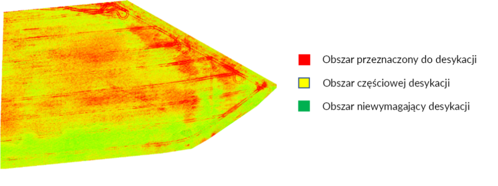
Dessication is a chemical procedure, which aims to dry (dessicate) the plants (mainly rapeseed) before harvesting (preparing cultivation for harvest) and fight the weeds. Thanks to the drone equipped with multispectral sensors, we are able to divide the field into areas that should be sprayed or shouldn’t. This kind of service has a positive impact on natural environment, saves a great deal of time and money and improves the quality of crops.
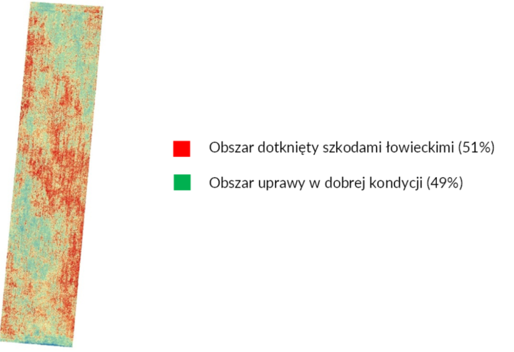
The ortophoto maps that we provide precisely reflect the real condition of the farm. By comparing the situation before and after the damage, we can easily estimate the affected area. If we use multispectral sensor, we are also able to calculate the extent of damages in specific regions.
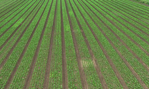
Multispectral and RGB (visible colors – red, green and blue) imagery allow us to estimate the size of yields and the number of seedlings. Predicting yields is very important in case of planning sales and storage. Next, counting the number of seedlings is helpful in insurance matters and assessing the condition of plants after winter or drought.
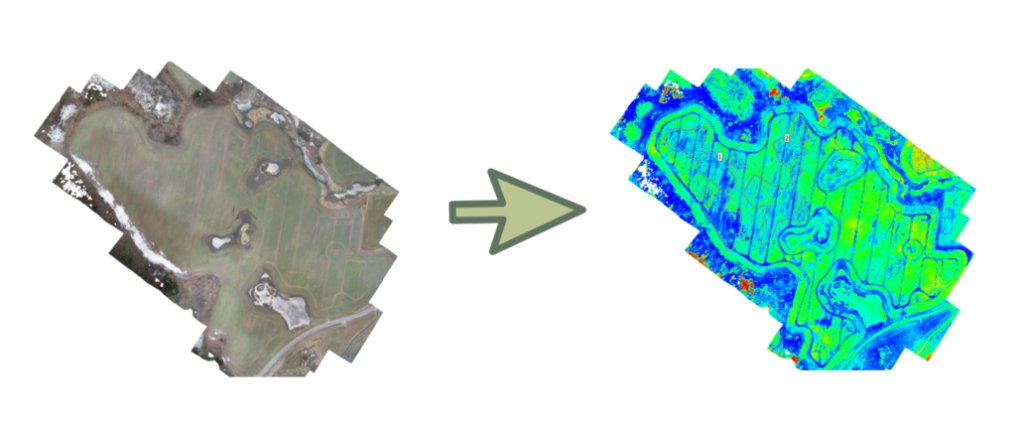
After conducting the multispectral mission with a drone equipped with suitable sensors, we can develop the full range of indices maps. Every map gives us different kind of information, for example about leaves transpiration or plants’ condition after winter. Our experience let us operate with remote sensing and photogrammetry products skilfully, that is why our analysis is as precise as it is possible. NDVI is just a beginning.
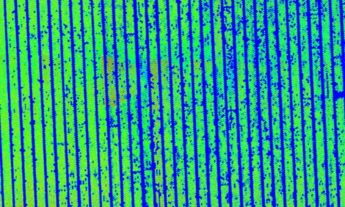
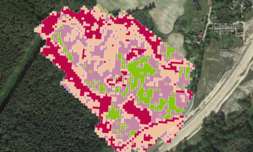
Efficient crop production is dependent on suitable fertilizing. Over fertilization is extremely dangerous for soil and water environment, damage the plants and make their taste worse. In view of the implementation of European Green Deal’s premises, rational fertilization not only will be a good practice, but it will become a necessity. Beside correct dose, date of application and right form of the fertilizer, precision is also very relevant in that procedure. And that is something what drones can provide.
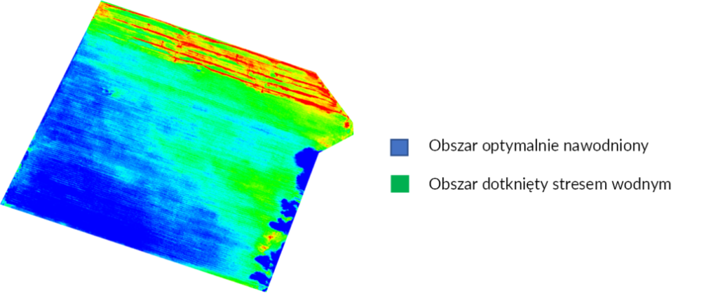
Owing to use of the drone equipped with thermal camera, we are able to develop thermal maps, which pixels are described with real, specific temperature. It lets us evaluate transpiration level (evaporation from aerial parts of plants, such as leaves, stems and flowers) – the higher temperature, the lower transpiration. Thanks to that measurement, we can estimate the level of stress caused bu excess or shortage of water.
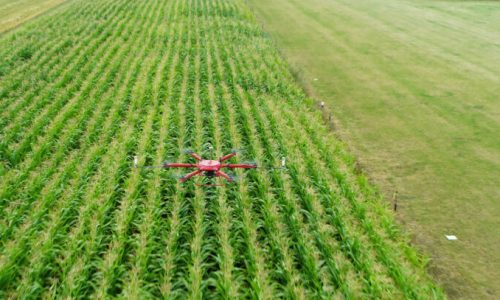
European corn borer is a pest, that every farmer who grows corn heard about. If he does not conduct special monitoring or would not take appropriate steps in case of finding it in the field, the crop loss might be even around 90%. The natural enemy of European corn borer is Trichogramma, which larva parasitise on its eggs. The effective way of Trichogramma’s application is the airdrop from a drone.
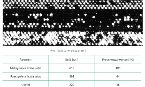
While preparing for the next sowing season, drone missions are invaluable help. Their goal is to map the area and work out which areas require additional work and what kind of job should be done to ensure uniform plant stand and good crops. Using photogrammetric and remote sensing methods, as well as artificial intelligence, we are able to determine the number of seedlings and losses in the beds. This allows you to optimize the production volume as well as reduce alternative costs.
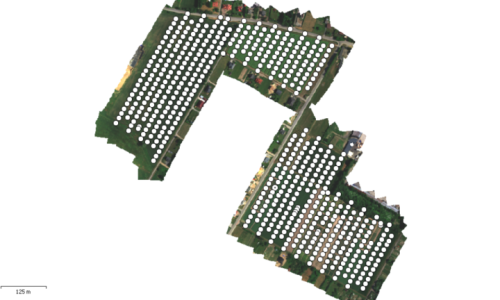
To map the interesting area, we conduct photogrammetry and remote sensing missions. Using selected drone and sensor we are able to acquire photo material, which is developed into chosen map. In case of photogrammetry mission we use high resolution camera (RGB visualization) and as far as remote sensing is concerned – multispectral cameras (it takes photos in a few different spectrum of light, inter alia near infrared).
More and more agriculture entrepreneurs use drones to optimize their production and reduce the costs. Developing and analyzing raw photogrammetry and remote sensing material requires specialized know-how, suitable hardware and advanced software. That is why our company provides analytic services, which let you seize the opportunities that gives us your drone.
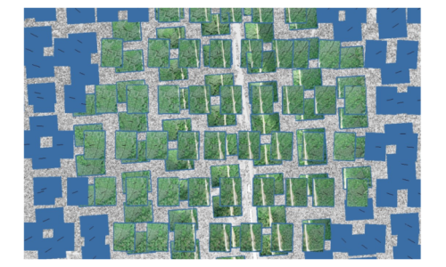
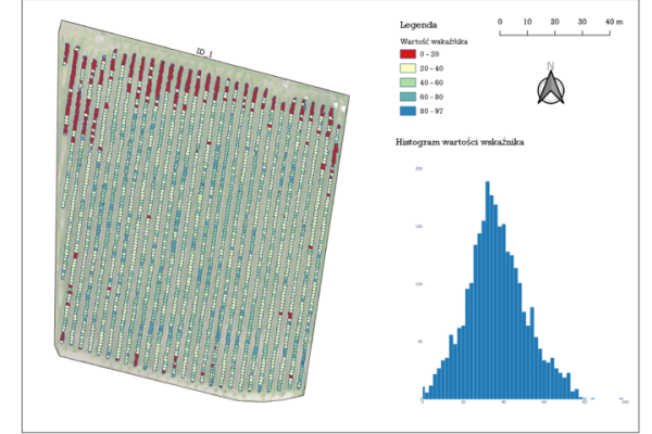
As part of precision gardening drone gives us the possibility to map our crops – it allows us to estimate production potential of single fruit trees or fruit bushes. Thanks to this kind of analysis, we can control the efficiency of respective strains and results of fertilizing and other agriculture practices. We are also able to identify the orchard areas characterized by good or bad condition, and based on that develop variable rate and flower thinning application maps.
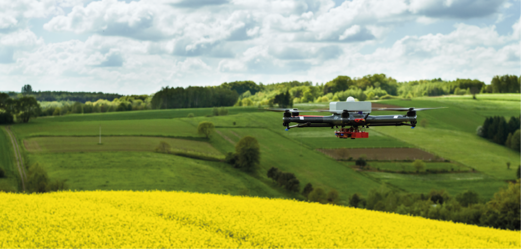
W celu zmapowania interesującego dla Klienta obszaru, wykonujemy naloty fotogrametryczne i teledetekcyjne. Przy pomocy wybranego drona i sensora pozyskujemy materiał zdjęciowy, który następnie może zostać przekształcony w odpowiednią mapę. W przypadku nalotu fotogrametrycznego używamy kamery cyfrowej o wysokiej rozdzielczości (wizualizacja w kolorach widzialnych RGB), natomiast w przypadku nalotu teledetekcyjnego kamerę multispektralną.
Coraz więcej przedsiębiorców rolnych posługuje się dronem w celu optymalizacji produkcji oraz redukcji kosztów. Opracowanie i analiza surowego materiału fotogrametrycznego lub teledetekcyjnego wymaga jednak specjalistycznego know-how, odpowiedniego sprzętu oraz zaawansowanego oprogramowania. Z tego powodu świadczymy usługi analityczne, które pozwalają wykorzystać w jak największym stopniu możliwości posiadanego drona.
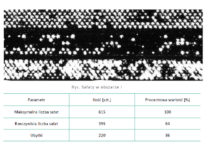
Przygotowując się do następnego okresu siewnego nieocenioną pomocą stają się naloty, mające na celu mapowanie terenu, czyli określenie, które obszary wymagają dodatkowych prac i jakiego rodzaju, aby zasiew był równomierny, a plony obfite. Wykorzystując metody fotogrametryczne i teledetekcyjne, a także sztuczną inteligencję, jesteśmy w stanie określić liczbę sadzonek oraz ubytków w zagonach. Pozwala to na zoptymalizowanie wielkości produkcji, jak również redukcję kosztów alternatywnych.
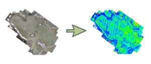
Lokalizowanie i identyfikowanie problematycznych obszarów upraw polega na ocenie uszkodzeń roślin w wyniku trudnych warunków przezimowania, wykrycia szkodników, zdiagnozowania obszarów o niewystarczającym nawadnianiu, itp.
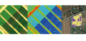
Efektywna produkcja roślinna uzależniona jest od odpowiedniego nawożenia. Nadmierna ilość nawozu jest niezwykle groźna dla środowiska glebowego i wodnego, szkodzi uprowaie oraz psuje smak warzyw. W perspektywie założeń unijnej strategii Zielonego Ładu, racjonalne nawożenie nie będzie już tylko dobrą praktyką, a stanie się koniecznością. W nawożeniu obok prawidłowo obliczonej dawki, terminu stosowania i wyboru właściwej formy nawozu, niezwykle ważna jest precyzja i oszczędność, którą zapewniają odpowiednio wyposażone drony.
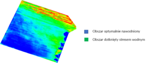 Wykorzystując drona wyposażonego w kamerę termowizyjną, jesteśmy w stanie opracować mapę termograficzną, wskazującą wartości temperatury odpowiadające każdemu pikselowi mapy. Pozwala to ocenić poziom czynnego parowania wody z nadziemnych części roślin, czyli tzw. transpiracji – im wyższa temperatura, tym mniejsza transpiracja. To z kolei umożliwia określenie poziomu stresu roślinwynikającego z niedoboru lub nadmiaru wody. Powstałe mapy często ukazują pogorszoną kondycję roślin w miejscach o wysokich lub niskich wartościach emitowanego ciepła.
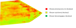 Desykacja jest zabiegiem chemicznym, mającym na celu dosuszenie roślin (głównie rzepaku) przed zbiorem (przygotowanie plantacji do zbioru), a także zwalczania zachwaszczenia. Dzięki wykorzystaniu drona wyposażonego w kamerę multispektralną, jesteśmy w stanie ustalić, na jakim obszarze należy wykonać oprysk, a na którym jest on niepotrzebny. Wpływa to pozytywnie na oszczędność czasu oraz środków przeznaczonych na herbicyd, a także jakość plonów i środowisko.
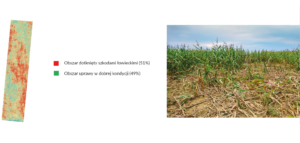 Zaawansowane metody fotogrametryczne i teledetekcyjne, które stosujemy w naszej pracy, pozwalają z dużą precyzją określić obszar zniszczeń dokonanych przez zwierzynę łowną lub zjawiska pogodowe. Pomagają nam w tym nasze autorskie drony. Straty wręcz niemożliwe do oszacowaniu z poziomu widzenia człowieka, np. w głębi pola lub w uprawach wysokich, są widoczne z perspektywy bezzałogowego statku powietrznego. Mogą one pomóc w procesie uzyskania pomocy finansowej lub odszkodowania, a także podjąć działania zabezpieczające uprawy i młode nasadzenia drzew.
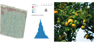 W ramach precyzyjnego rolnictwa drony dają możliwość mapowania plonów, czyli szacowania potencjału produkcyjnego pojedynczych drzew lub krzewów owocowych. Bazując na takich analizach, jesteśmy w stanie kontrolować wydajność poszczególnych odmian oraz ocenę efektów nawożenia i innych zabiegów agrotechnicznych. Mapy plonów opracowywane regularnie przez kilka lat dostarczają ważnych informacji o zmienności plonowania na obszarze danego gospodarstwa. Dysponując taką wiedzą możemy zidentyfikować obszary pola charakteryzujące się gorszą lub lepszą kondycją uprawy. Mapy plonów służą także do tworzenia map aplikacyjnych zmiennego nawożenia oraz strefowych oprysków w przypadku przerzedzania kwiatów w celu uzyskania owoców o jak najwyższej jakości.
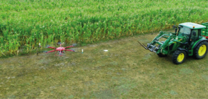
Omacnica prosowianka to szkodnik, o którym z pewnością słyszał każdy przedsiębiorca rolny uprawiający kukurydzę. Jeśli nie prowadzi on specjalnego monitoringu,a w przypadku zauważenia omacnicy na polu nie podejmie odpowiednich kroków, utrata jego plonu może wynieść nawet do 90%. Naturalnym wrogiem omacnicy jest kruszynek, którego larwy pasożytują na jej jajach. Efektywnym sposobem aplikacji kruszynka jest zrzut formy sypkiej wykorzystując w tym celu Agrodron.
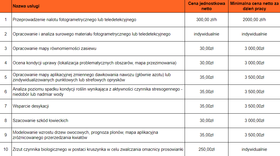 * Przy projektach przekraczających 250ha istnieje możliwość negocjacji ceny
